eReference Library
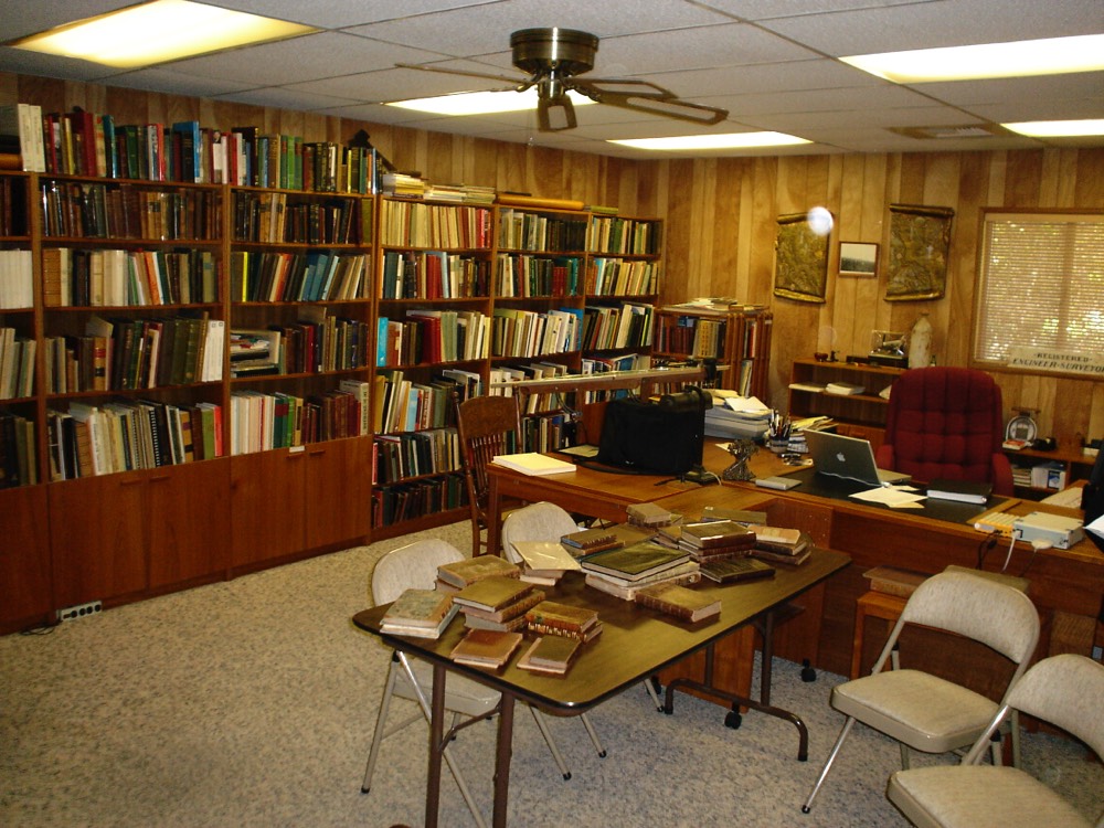
Bud Uzes' Office & Reference Library - Circa 2005 - After 50 Years of Collecting
The Modern Reference Library - Your Laptop or Tablet
Things have changed. In a few days time, I found and downloaded digital versions of more than 50% of the old books and instrument catalogs Bud spent a lifetime acquiring (at a considerable expense).
To help surveying instruments collectors and historians, I'm posting all the textbooks and instrument catalogues I found, plus other reference materials that you may find helpful, on my website. All of this stuff is in the public domain.
And no surveying digital library would be complete without a copy of Bud Uzes' Illustrated Price Guide to Antique Surveying Instruments and Books (published in 1980).
Surveying Books Used in America - 1600 to 1900
One important element in compiling a list of surveying books used in the United States is determining when surveying was first practiced in the colonies. The beginning of the 17th century corresponds with the first lasting settlement by the English in Virginia. That event took place in 1607 and was followed by the landing of the Mayflower in 1620 whereupon the colony of Plymouth was founded. Although the question of when surveying began remains unanswered, further insight is provided in a statement appearing in John Love's Geodaesia: or, The Art of Surveying and Measuring of Land Made Easie. (1688):
- - - and if you ask, why I write a Book of this nature, since we have so many very good ones already in our own Language? I answer, because I cannot find in those Books, many things, of great consequence, to be understood by the Surveyor. I have seen Young men in America, often nonplus'd so, that their Books would not help them forward, particularly in Carolina, about Laying out Lands, when a certain quantity of Acres has been given to be laid out five or six times as broad as long. This I know is to be laught at by a Mathematician; yet to such as have no more of this Learning, than to know how to Measure a Field, it seems a Difficult Question: And to what Book already Printed of Surveying shall they repair to, to be resolved?
While the information is meager it seems certain that surveying was being practiced in the American colonies during the 17th century. Lacking evidence of earlier work it was decided to begin the present compilation with the year 1600.
Surveying book entries dated before 1800 include all English-language works that were either used or were susceptible to having been used in America. Those after 1800 are limited to ones published in the United States with the exception of a few specialty books for which no local counterpart was then available. This compilation contains instructional or "how-to" books and does not include such items as manufacturer's catalogs, etc. The inclusion of government surveying manuals is limited to individually published works having either widespread application or particular significance.
(Bud Uzes compiled this list in 2001, and the list was last updated in 2003. There might have been a few discoveries since then. I am in the process of linking the titles to digital copies of the books - whatever edition I can find.)
Hopton, Arthur, Speculum Topographicum, or the Topographicall Glasse, (London, 1611). This is a general treatise on land surveying and dicusses the instruments and methods then in use. There are many illustrations showing examples of horizontal and vertical triangles used for determining distances and heights. Hopton wrote another surveying-related work the previous year titled Baculum Geodaeticum Sive Viaticum.
Rathborne, Aaron, The Surveyor in Foure Bookes, (London, 1616), 228 pages. This is one of the all-time classics in surveying literature and set the stage for books that would follow for over 200 years. It contains much history on the manor system in addition to surveying fundamentals. The title page shows instruments of the period including an elaborate theodolite.
Leybourn, William, The Compleat Surveyor: Containing The whole Art of Surveying of Land, by the Plain Table, Theodolite, Circumferentor, and Peractor. (London, 1653), 279 pages with numerous illustrations, diagrams throughout and a portrait of the young Leybourn. This was a major work of the period and was reprinted numerous times with the 5th edition of 1722 being substantially expanded upon by Samuel Cunn. The Cunn version included a number of fancied surveying illustrations of which some have been reprinted in recent times and at times incorrectly credited to the 1653 edition. Each edition of the book was larger in content and substance and brought the work to a standard that exceeded most others of the time. 1674 Edition. 1722 Edition.
Eyre, J., The Exact Surveyor: or, The whole Art of Surveying of Land, (London, 1654), 224 pages. This is a pocket size work that includes use of the plain table, theodolite and circumferentor. It also instructs on how to plot maps, calculate area, divide land, and account for the difference in length between the statutory and customary pole.
Atwell, George, The Faithful Surveyor, (London, 1658). Atwell was a surveyor and instructor and advocated using the chain and plain table in preference to other instruments.
Wing, Vincent, Geodaetes Practicus: or, The Art of Surveying, Surveyed and laid out in a more Accurate, Plain and Expeditious Plat, then hath hitherto been performed.(London, 1664), 325 pages. Wing is the designer of the 40-link two-pole chain that he stresses the value of when surveying tracts in rods or poles. The work is small in size and intended for use as a pocket book in the field. Almost all copies of the 1666 2nd edition were burned in the great London fire and only 3 are known to survive today. The fire damage is mentioned in William Leybourn's own 1674 surveying book, noting that Leybourn was the publisher of Wing's books. The imposing and much larger 3rd edition was published in 1700 by Vincent's nephew, John Wing.
Holwell, John, A Sure Guide to the Practical Surveyor, (London, 1678). The plain table and semicircle with Gunter's chain are considered sufficient and preferred over needle instruments due to the change in variation.
Martindale, Adam, The Country-Survey-Book: or, Land-Meters Vade-Mecvm, (London, 1682, 1702), 234 pages illustrated with copper plates. This is a pocket size book that focuses on surveying with the chain and use of the plain table. It is intended for youths who prefer a smaller and less expensive work. A number of subsequent printings were made into the 18th century.
Love, John, Geodaesia: or, The Art of Surveying and Measuring of Land Made Easie. As also How to Lay out New Lands in America, or Elsewhere:…, (London, 1688), xxii, 196, 52 . Love published his first edition after returning from surveying in America. He was particularly concerned about the lack of knowledge exhibited by young surveyors in Carolina. Later editions of the book appeared for over a century with the 12th (1793) and 13th (1796) editions being published in New York. The work changed little over the years, even considering the later revisions of Samuel Clark. Instructions are given in use of a Gunter chain and measuring angles with the circumferentor, plane table, and semicircle. There are also directions for taking field notes and measuring and calculating the acreage for plots of land. George Washington (1732-1799) studied surveying from Love's Geodaesia which was widely used in America.
Wyld, Samuel, The Practical Surveyor, or, the Art of Land-Measuring Made Easy, (London, 1725), 182+ pages with 5 plates plus a frontispiece that illustrates instruments made by J.Sisson including a theodolite, level, pantograph, protractor and scale. This is the first English-language text to picture the theodolite as a telescopic instrument capable of measuring horizontal and vertical angles. Subsequent editions followed in later years including a 4th edition in 1760.
Wilson, Henry, Surveying Improv'd: or, The Whole Art, Both in Theory and Practice, Fully Demonstrated. (London, 1726), 320 pages with 11 folding plates. This is a very comprehensive text and describes use of chains, surveying wheel, theodolite, circumferentor, semicircle, plain table and scales. Beginning in 1741 the later editions were supplemented with information provided by William Hume. 1760 Edition.
Gray, Vincent, The Art of Land-Measuring Explained. (Glasgow, 1757), 307 pages including an appendix explaining instrument, together with 9 folding plates. Gray preferred use of the chain for both linear and angular measure. He advocates that the chain should have 6-inch long iron spikes at the ends rather than wire ring handles that were likely to lengthen with use.
Hammond, John, The Practical Surveyor: Shewing, Ready and Certain Methods for Measuring and Mapping and Adorning All Sorts of Lands and Waters, by the Several Instruments Now in Use: Particularly, of a New Theodolite, 2nd Ed., (London, 1731), 189 pages with 3 folding plates and a frontispiece illustrating instruments made by Thomas Heath including the new improved theodolite, double level and universal dial.
Laurence, Edward, The Surveyor's Guide: or, A New Introduction to the Whole Art of Surveying Land, Both by the Chain and all Instruments Now in Use, 3rd ed., (London, 1736), 231 pages of text, 145 pages of tables and 6 plates. This work was first published in 1716 as The Young Surveyor's Guide. Laurence was a surveyor and particularly fond of the theodolite with telescopic sight for taking angles and suggests that every practitioner will soon find the advantage.
Gardiner, William, Practical Surveying Improved: or Land Measuring According to the Most Correct Methods, (London, 1737). This book contains a detailed description of Sisson's improved theodolite. It also includes information on the plain table, chain and circumferentor.
Hawney, William, Hawney's Complete Measurer: or, The Whole Art of Measuring. In Two Parts . 6th ed., (London, 1748) 346 pages. This work contains an Appendix on Land-Surveying and was first published in 1717. It was a standard work on the subject and widely used. Later editions were published in America including an 1802 edition in Philadelphia. It was published as late as 1820.
Milton, Abraham, The Farmer's Companion, Directing How to Survey Land After a New and Particular Method, (Annapolis, 1761), 34 pages. The author also published in the same year the book The Farmer's Companion; Instructing How to Run Land Without a Compass, and Plot the Same in an Easy Manner.
Noble, Benjamin, Geodaesia Hibernica: or an Essay on Practical Surveying, (Dublin, 1768); 108 pages of text, 47 pages of tables and 2 folding plates. The surveyor is cautioned to invest in a good instrument as many have faults such as unequal divisions to the circle, center wrongly placed, and iron particles in the brass. The focus is mostly on calculating area of irregular parcels.
Gibson, Robert, A Treatise of Practical Surveying; Which is demonstrated From its First Principles. Wherein Every Thing that is Useful and Curious in that Art is fully considered and explained, 3rd ed, (Dublin, 1768), 319 pages with 12 folding plates. During the late 18th and early 19th centuries, Gibson's Surveying was the American standard against which other works were compared. The earlier editions of 1739, 1752, 1768 and 1777 were published in Dublin. The first American edition was published in 1785 in Philadelphia. Gibson describes use of the circumferentor, theodolite, semicircle, and plane table. He also describes and gives examples for the taking of field notes and the calculation of areas. In the 1800's two versions of Gibson were being offered by different publishers. One was as revised by James Ryan and the other by John D. Craig. The Craig revision moved the individual diagrams into the text thus eliminating the problem of damage to folded plates.
Breaks, Thomas, A Complete System of Land-Surveying, Both in Theory and Practice, Containing the Best, the most Accurate, and Commodious Methods of Surveying and Planning of Ground by all the Instruments now in Use; with Regular Forms of keeping a Field-Book or Journal, (Newcastle-upon-Tyne, 1771), 593 pages plus 17 folding plates. This is a monumental work that is head and shoulders above others of the period although probably too advanced for the average surveyor of that period. It is comprised of 11 sub-books and includes information on the improved theodolite with spirit level and nonius, plane table, sector, chain and perambulator.
Burns, Arthur, Geodaesia Improved; or, a New and Correct Method of Surveying Made Exceeding Easy, (Chester, 1771), 353 pages with 5 folding plates. Burns points out the one big advantage of his book is that it is written by a surveyor having practical experience in the subject.
Carter, John, The Young Surveyor's Instructor; or an Introduction to the Art of Surveying, (Philadelphia, 1774), 64 pages. This book was intended to assist one in becoming a teacher without the help of a teacher.
Waddington, R., The Land Surveyor's Companion; containing the Theory and Practice of Geometry, Mensuration, Land Surveying, Dividing, Leveling, Draining, &c., (London, n.d., c. 1778), 189 pages of text and 4 folding plates showing numerous figures. This book is unique both in its content and rarity. It contains very detailed and practical instructions for surveying by the chain and staff, leveling, angular measure, adjusting instruments, taking field notes and calculating area. It describes at length and draws comparisons between theodolites made by Sisson, Heath and Ramsden, and also of two types of circumferentor. This work does not appear in any authoritative book list nor are copies found in other large collections.
Harding, Thomas, Tables of Latitude and Departure with An Essay on their Origin and Use; Particularly As they are suited to the Purposes of Land Surveying: Also, An Appendix, containing An Illustration of all the Methods of Calculation Hitherto Practised, and a Specimen of Eight New Methods, Never Before Published, (Dublin, 1788). Authors of 18th century surveying books placed particular emphasis on mathematical calculations, particularly for the determination of area of a closed figure. Harding devotes an entire work to this subject and compares the methods of other writers. There are 25 pages of text, 5 foldout pages, and 90 pages of traverse tables.
Moore, Samuel, An Accurate System of Surveying, (Litchfield, 1796), 131 pages of text including 8 pages of tables. This is the first substantive totally American work on surveying. It focuses on the need for mathematical skills by the surveyor.
Adams, George, Geometrical and Graphical Essays, Containing a Description of the Mathematical Instruments used in Geometry, Civil and Military Surveying, Levelling and Perspective; with many New Problems, (London, 1791), 500 pages of text and having a frontispiece engraving of a new theodolite capable of measuring both horizontal, vertical and oblique angles. This book came with a companion volume of 32 copper plates that was usually bound separately. Adams was a professional surveyor and instrument maker and produced here one of the very best surveying books of the period. Adams died in 1795 after which date William Jones published corrected and enlarged editions of the work in 1797, 1803 and 1814.
Redfield, Nathan, A Treatise of Surveying, (1796). No copy of this work is known although it is listed in a biographical work.
Ellicott, Andrew, Several Methods by Which Meridianal Lines may be Found with Ease and Accuracy: Recommend to the Attention of the Surveyors of the United States, (Philadelphia, 1796), 32 pages and 2 plates.
Little, Ezekiel, The Usher, Comprising Arithmetic in Whole Numbers; Federal Money; Decimal and Vulgar Fractions; A Description and Use of Coggeshall's Sliding Rule; Some Uses of Gunter's Scale; Superficial and Solid Measuring; Geometrical Definitions and Problems; Surveying; The Surveyor's Pocket Companion, or, Trigonometry Made Easy; A Table of Sines; A Table of Tangents; Miscellany; Tables of the Weight and Value of Gold Coins, Calculated and Designed for Youth, (Creter, 1799), sold by the booksellers in Boston, Newburyport, Portsmouth and other locations; 240 pages The author mentions the theodolite, semicircle and common compass and suggests that each of them may be better understood by a sight of them. A description is given for use of the plain table.
Dix, Thomas, A Treatise on Land-Surveying, (London, 1799), 193 pages with 9 folding plates. A separately bound set of sample field notes accompanied this work as plate 10. A November 1882 article appearing in Engineering News states this work was one of the three most widely used in America by colonial surveyors although copies are not seen today with the frequency of other texts. Subsequent editions appeared as late as 1841.
Jess, Zachariah, A Compendious System of Practical Surveying, and Dividing of Land: Concisely Defined, Methodically Arranged, and Fully Exemplified. The Whole Adapted for the Easy and Regular Instruction of Youth in our American Schools. (Wilmington, Bonsal and Niles, 1799). This was an adequate text for classroom instruction at the time. A second edition was published in 1814.
Dewey, Solomon, A Short and Easy Method of Surveying: Adapted to Every Capacity; Designed Chiefly for Schools and Common Practice: to Which is Added the Square Root, (Hartford, 1799), 24 pages.
Cook, David, Cook's American Arithmetic; Being a System of Decimal Arithmetic; Comporting with the Federal Currency of the United States of America. To Which is Annexed, by Way of Second Part, The American Surveyor. A Draught of Instruments, Adapted to Carry the Above into Effect. The Work is Rendered Easy, and may be of Great Use to the Citizens of the United States, (New Haven, 1800), 116 pages.
Eaton, Amos, Art Without Science, or Mensuration, Surveying and Engineering, Divested of the Speculative Principles and Technical Language of Mathematics, (c. 1800), 12 pages. In 1830 this work was enlarged and republished with 96 pages. At that time the first work was described although no known copy has been located.
Weber, Samuel, Mathematics, Compiled from the Best Authors and Intended to be the Text-Book of the Course of Private Lectures on These Sciences in the University of Cambridge, in Two Volumes, (Boston, 1801), Vol. 1 contains 426 pages and Volume II contains 610 pages. The surveying portion, including heights and distances, comprises pages 169 through 270 in Volume II. The instruments described include the plane table, theodolite, cross, circumferentor, and smaller items.
Fenwick, Thomas, A Theoretical and Practical Treatise on Subterraneous surveying, and the Magnetic Variation of the Needle, (Newcastle-upon-Tyne, 1804), 207 pages and 7 folding plates. This was the primary work on mine surveying for which no counterpart existed in America. Later editions were published in 1822 and 1861.
Flint, Abel, A System of Geometry and Trigonometry; together with a Treatise on Surveying, (Hanford, 1804), viii, 82, 84, 4 folding plates. Editions of Flint's Surveying were published for a half century beginning in 1804. It was a widely used text and reference book. A testimonial by two noted surveyors states: "The Surveyor who shall own this will not be under the necessity of purchasing Gibson which is a more expensive work." Abraham Lincoln reportedly studied from texts by Gibson and Flint.
Conway, Miles, Geodaesia, or a Treatise of Practical Surveying Wherein Several Things That are Useful and Necessary in that Art are Considered and Explained, Particularly, Several Very Concise Methods for Determining the Area of Surveys by Calculation in Different Forms, and Several Different Tables Adapted for that Purpose. Made for the Use of Western Surveyors in Particular, or may be Useful to Others. (Lexington, KY, 1807), 60 pages.
Gummere, John, A Treatise on Surveying, containing the Theory and Practice to which is prefixed, a Perspicuous System of Plane Trigonometry, (Philadelphia, 1814), 202 pages of text and 152 pages of tables, with 8 folding plates. Gummere's Surveying was one of the major surveying texts of the 19th century and revised editions were published for over a century. The book focused on giving examples of surveying problems. The major angle-measuring instrument of the pre-1850 era was the English theodolite and its operation is described in the text.
Fairlamb, Jonas Preston, A New and Concise Method of Completely Obviating the Difficulty Occasioned in Surveying by Local Attractions of the Magnetic Needle . . ., (Wilmington, 1818), 15 pages.
Hanna, James, The American Instructor: or, Every One of His Own Teacher: Comprising . . . Spelling, Reading . . . Arithmetic, Surveying, Carpenters' Measurement, Bookkeeping, by Double Entry, (Trenton, 1818), 304 pages.
Messinger, J.A., A Manual or Handbook Intended for convenience in Practical Surveying, (1821).
Farrar, John, An Elementary Treatise on the Application of Trigonometry to Orthographic and Stereographic Projection, Dialling, Mensuration of Heights and Distances, Navigation, Nautical Astronomy, Surveying and Levelling, (Cambridge, New England, 1822), 153 pages of text plus 71 pages of tables, 9 plates. This work was designed for the use of the students of the University at Cambridge, New England. Subsequent editions continue to the 4th in 1840.
Von Ville, S.W., Del Bauer als Landmesser, oder die Practische Feldmesskunst, (Reading, PA, 1824), 154 pages and 6 plates on 2 fold-out leaves. This is the only known American surveying book printed in the German language.
Hale, James, Elements of Geometry & Trigonometry, with an Easy and Concise System of Land Surveying, (Bellows Falls, VT, 1829), 70 pages of text plus 45 pages of tables. This simplified pocket-sized book includes descriptions of the circumferentor and chain.
Davies, Charles, Elements of Surveying, (New York, 1830), 147 pages of text plus 153 pages of tables and 9 folding plates. This was the first of a series of Davies' books on surveying and was intended for use of the students at West Point. Beginning in 1835 the content was modified for use outside the academy. Later editions had different titles and expanded sections including navigation. Davies Surveying dominated the market during the mid-19th century and was a major contribution to the development of surveying within the United States. Despite being periodically updated it never really kept pace with the advancing technology and doesn't include material on the commonly-used surveyors transit until the 1883 version published by J. Van Amringe. Nonetheless it was very popular and provided guidance for a large number of surveyors during the mid-19th-century. The various titles with the beginning years are: Elements of Surveying (1830), Elements of Surveying and Navigation (1841), Elements of Surveying and Levelling [sic] (1870), and Elements of Surveying and Leveling (1883).
Hutton, Charles, Course of Mathematics for the Use of Academies as Well as Private Tuition, in Two Volumes, the Fifth American from the Ninth London Edition with Many Corrections and Improvements, by Olinthus Gregory, with the Additions of Robert Adrain, The Whole Corrected and Improved, Volume I, (New York, 1831). This work covers a multitude of mathematical subjects, including a 29-page section on surveying.
Bourne, A., The Surveyor's Pocket-Book, Containing Brief Statements of Mathematical Principles, and Useful Results in Mechanical Philosophy, Compiled from Various Sources, and Designed Principally as a Book of Reference for Surveyors and Civil Engineers, (Chillicothe, Ohio, 1834), 147 pages of which 15 pages are particularly about surveying and 40 are mathematics. This is the first surveying text to include material of the U.S. public land surveys, including certain changes in 1833 in the procedures for conducting that type of work. Alexander Bourne was a noted Ohio mapmaker and surveyor.
Mifflin, Samuel W., Methods of Location or Modes of Describing and Adjusting Railway Curves and Tangents as Practised by the Engineers of Pennsylvania, (Philadelphia, 1837), 41 pages. This is the earliest known book to mention the American surveyor's transit and include instructions for its use.
Day, Jeremiah, The Mathematical Principles of Navigation and Surveying, with the Mensuration of Heights and Distances: Being the Fourth Part of A Course of Mathematics, Adapted to the Method of Instruction in the American Colleges. (New Haven, 1831, 1839), 119 pages and 3 folding plates. First published in 1817, this work stresses the principles of surveying rather than delving into the details that are necessary for the practical surveyor.
Ryan, James, A Treatise on the Art of Measuring Containing All That is Useful in Bonnycastle, Hutton, Hawney, Ingram and Several Other Modern Works on Mensuration: To which are added Trigonometry, with Its Application to Heights and Distances: Surveying: Gauging: and also the Most Important Problems in Mechanics. (New York, 1831), 344 pages. James Ryan was earlier involved in a surveying text when in 1812 he revised Gibson's Surveying. This work has 53 pages specifically devoted to surveying plus chapters on geometry, trigonometry and other mathematical subjects.
Dunham, Thomas, A New Method of Teaching Navigation and Surveying, Not Before Published, (New Bedford, MA, 1834), 18 pages.
Peirce, Benjamin, An Elementary Treatise on Plane Trigonometry, with its Applications to Heights and Distances, Navigation, and Surveying, (Cambridge and Boston, 1835), 90 pages and 1 folding plate. This book presents mathematical elements with little practical surveying. Peirce was Superintendent of the U.S. Coast Survey from 1867 to 1874. In 1840 he greatly expanded this work to include treatment of spherical trigonometry and explanations of applications to Bowditch's Navigator and Nautical Almanac.
Simms, Frederick W., A Treatise on the Principal Mathematical Instruments Employed in Surveying, Levelling and Astronomy, revised, with additions, (London, 1836), 115 pages. This work has little instructional material but does provide descriptions of the instruments in use.
Pomeroy, Ralph W., The Engineer’s Practical Elements, containing Surveying, Draughting, Geodesic Operations, Mensuration, Explanation and Employment of Instruments, &c., on the Basis of Lacroix, (Philadelphia, 1836). This is a pocket-sized work that emphasizes French surveying techniques and map preparation. The content includes instructions on how to perform numerous field tasks together with illustrations of the various instruments.
Alsop, Samuel, A Complete Key to Gummere's Surveying (Philadelphia, 1837), 84 pages plus 2 folding plates. This work contains worked examples to 19 problems found in Gummere's Surveying.
Simms, Frederick W., A Treatise on the Principles and Practice of Levelling, (Baltimore, 1837), 121 pages of text, 32 pages of tables and 4 plates. This is the American edition of a work by an English author and exhibits that influence. It was reprinted several times including a 5th edition in 1870.
Mifflin, Samuel W.., Methods of Location or Modes of Describing and Adjusting Railway Curves and Tangents as Practised by the Engineers of Pennsylvania, (Philadelphia, 1837), 41 pages.
Millington, John, Elements of Civil Engineering, (Philadelphia, 1839), 725+ pages with 8 folding plates. This book devotes 47 pages to land surveying along with the various elements of civil engineering..
Eaton, Amos, Prodromus of a Practical Treatise on the Mathematical Arts: Containing Directions for Surveying and Engineering, (Troy, NY, 1838), 191 pages. There was also an 1848 edition.
Roberts, William, A Specification and Treatise on Monumental Surveying, (Troy, 1839), 53 pages.
Stevenson, David, A Treatise on the Application of Marine Surveying & Hydrometry to the Practice of Civil Engineering, (Edinburgh & London, 1842), 173 pages and 13 plates. This is a leading work on the subject of hydrographic surveying and includes treatment of tide measuring, triangulation, soundings, etc.
McLallen, Robert L, A New and Interesting Arithmetic, in Which is Explained the Method that Zerah Colburn Must Have Pursued in Answering the Very Difficult Questions Proposed to Him. . . To Which is Added, The Surveyor's Art - Abridged, (North Adams, MA, 1844), 212 pages.
O'Shaughnessy, P.A., A Treatise on Surveying and Civil Engineering, Wherein Everything That is Useful and Curious is Demonstrated from its First Principles, (New York, 1848), 98 pages.
Whitlock, Rev. George Clinton, Elements of Geometry, Theoretical and Practical: Containing a Full Explanation of the Construction and Use of Tables, and A New System of Surveying (New York, 1849), 324 pages. This work mostly treats mathematics but does minimally include material on use of the compass, theodolite, level, cross and chain. Check out this Picture in Whitlock.
Borden, Simeon, A System of Useful Formulae Adapted to the Practical Operations of Locating and Constructing Railroads, (Boston, 1851), 188 pages.
Perkins, George R., Plane Trigonometry and its Application to Mensuration and Land Surveying, (New York, 1852). This book has 153 pages of text plus 175 pages of mathematical tables. Perkins was Principal and Professor at the New York State Normal School and this work focuses on the mathematics involved in dividing land and calculating area. It describes the process of chaining and includes a description of the surveyors compass and a rudimentary cross. It mentions a theodolite but not the transit instrument. The theodolite is said to be too complicated for this level of text.
Robinson, Horatio N., A Treatise on Surveying and Navigation: Uniting the Theoretical, Practical and Educational Features of these Subjects, (Cincinnati, 1852), 230 pages of text and 101 pages of tables. This is a basic university textbook and gives general treatment of the subject. It revised up to a 4th edition in 1862.
Hackley, Rev. Charles W., A Treatise on Trigonometry, Plane and Spherical, with its Applications to Navigation and Surveying, Nautical and Practical Astronomy and Geodesy, (New York, 1853), 372 pages of text and 129 pages of tables not sequentially numbered. This book is mostly one of mathematical content and the section on practical surveying includes only 31 pages with a superficial treatment of the subject.
Loomis, Elias, Elements of Plane and Spherical Trigonometry, with their Applications to Mensuration, Surveying and Navigation, (New York, 1853, 1856) 178 pages. Loomis was a professor of mathematics and natural philosophy at the University of New York and published other scientific works including astronomy. This treatise contains the rudiments of surveying and describes and illustrates all the instruments in common use. Numerous editions were published including as late as 1891. The earliest reported edition is 1848.
Pedder, James, The Farmer's Land-Measurer, or Pocket Companion; showing, at one view, the Content of any Piece of Land, (New York, 1854), 19 pages of text and 124 pages of tables. This work offers very little other than simple area computation but was periodically reprinted as late as 1920. The first edition was reportedly published in New York in 1842.
Beans, E.W., A Manual for Practical Surveyors, Containing Methods Indispensably Necessary for Actual Field Observations, (Philadelphia, 1854), 108 pages. This is a small book but includes much in the way of practical techniques for field work.
Duncan, Andrew, The Practical Surveyor's Guide, Containing the Necessary Information to Make any Person of Common Capacity, A Finished Land Surveyor, Without the Aid of a Teacher, (Philadelphia, 1854), 122 pages. Like the Beans manual, this is small in size but contains valuable information for guiding a surveyor in field work. It gained in popularity and was published well into the 20th century.
U.S. General Land Office, Instructions to the Surveyors General of Public Lands of the United States, for those Surveying Districts Established in and Since the Year 1850; Containing, Also, A Manual of Instructions to Regulate the Field Operations of Deputy Surveyors, (Washington, 1855), 56 pages and 3 folding plates. This is the first of the general instructions following similar works intended for use in individual surveying districts. Revised editions were printed in 1881, 1890, 1894, 1902, 1919 (Advance Sheets), 1930, 1947 and 1973. Some of the editions were reprinted at different dates. Supplemental instructions were also published from time to time.
Smyth, William, Elements of Plane Trigonometry, Surveying and Navigation, (Boston and Portland, 1855), 216 pages and 4 folding plates. This book covers the basic surveying operations and includes descriptions of the compass, level, theodolite, plain table, chain, and has a section on triangulation. An enlarged edition with 272 pages of text plus 81 pages of mathematical tables was published in 1856. Included in the new material is treatment of the surveyor's transit. The illustrations formerly on folding plates are now inserted within the text. These changes measurably boosted the value of this work to surveyors.
Gillespie, W.M., A Treatise on Land-Surveying: Comprising the Theory Developed from Five Elementary Principles; and the Practice with the Chain Alone, the Compass, the Transit, the Theodolite, the Plane Table, &c. Illustrated by Four Hundred Engravings, and a Magnetic Chart, (New York, 1855), 424 pages of text and 40 pages of tables. This is one of the best of the 19th century texts and elevated training of surveyors to a higher plateau. It gained considerable popularity and was published into the 20th century with the later editions being enlarged by Cady Staley. The work became so voluminous that it was at times published in 2 volumes, the second being Higher Surveying.
Alsop, Samuel, A Treatise on Surveying; in Which the Theory and Practice are Fully Explained, (Philadelphia, 1857), 331 pages of text and 100 pages of tables. This is another fine text of the mid-19th century. It contains an excellent treatment of both instruments and procedures. It was short-lived and disappeared from the scene in later years.
Alsop, Samuel, Key to a Treatise on Surveying, (Philadelphia, 1857), 98 pages with diagrams. This work contains numerous worked examples to problems found in Alsop's Surveying.
Burt, William A., A Key to the Solar Compass, and Surveyor's Companion; comprising All the Rules necessary for Use in the Field., (Philadelphia, 1858), 126 pages of which 84 are text and 42 are tables. This is an important work regarding public lands surveying as well as operation of the solar compass that was invented by Burt. His first work on that instrument was Description of the Solar Compass, together with Directions for its Adjustment and Use, (Detroit, 1844). Several editions of the more complete work were published, even into the 20th century. This is a very tough book to find. Check out the picture of Burt's Solar Compass.
Grumman, J.M., A Short Treatise on Surveyors' Chains & Chain Measuring with the Subject of Measurements Generally, in the City and Country, 2nd ed., (Brooklyn, 1859, 1860), 24 pages. This brief work discusses measuring with the Grumman patent chain.
U.S. Coast Survey, General Instructions in Regard to the Hydrographic Work of the Coast Survey, undated ,c. 1860, 28 pages. This paper was separately published and not included as an appendix to the Superintendent's Report. Other hydrographic instructions were published in 1878, 1883, and 1894.
Root, Oren, A New Treatise on Surveying and Navigation Theoretical and Practical: with Use of Instruments, Essential Elements of Trigonometry, and the Necessary Tables, for Schools, Colleges, and Practical Surveyors, (New York, 1863, 1864), 398 pages of text plus 123 pages of tables. This is a nice basic text although for this period is a little light in its treatment of instruments. This work underwent several reprints and revisions to as late as 1891.
Bradbury, William F., The Elements of Plane Trigonometry, and Their Application to the Measurement of Heights and Distances, Surveying of Land, and Levelling. Particularly Adapted to the Use of High Schools and Academies, (Boston, 1864), 130 pages of text and 174 pages of tables. The author presents here an elementary work that can be used at the high school level. The book was reprinted in 1892.
Harrison, A.M., Assistant, On the Plane-Table and its use in Topographical Surveying, (Washington, 1867). This work is Appendix No. 22 and comprises pages 203 to 231 of the Report of the Superintendent of the United States Coast Survey Showing the Progress of the Survey During the Year 1865. There are 3 folding plates accompanying this work. The Coast Survey played a leading role in mapping the coasts of America and this work was the guide used by their topographers. The Harrison report was also copied and privately published in 1869 by D. Van Nostrand, New York. This private reprinting of the Harrison report continued with changed plates until at least 1884. A later U.S. Coast & Geodetic Survey version with the title A Treatise on the Plane-Table and its use in Topographical Surveying was written by E. Hergesheimer and published in 1882 as Appendix No. 13 to the Superintendent's Report for 1880. Subsequent editions appeared in the 20th century as late as 1922.
Schuyler, A., Surveying and Navigation, with a Preliminary Treatise on Trigonometry and Mensuration, (Cincinnati & New York, 1864, 1873), 403 pages of text and 87 pages of tables. This book is of the same nature as Robinson and Root although going into much greater detail in its treatment of instruments, including the solar compass.
Hawes, J.H., System of Rectangular Surveying Employed in Subdividing the Public Lands of the United States; also Instructions for Subdividing Sections and restoring Lost Corners of the Public Lands; Constituting a Complete Text-Book of Government Surveying, (Philadelphia, 1868), 234 pages of text. Hawes was Late Principal Clerk of Surveys in the General Land Office and this book deals exclusively with that subject. The author enunciates on how the work is to be carried out based upon office policy and his interpretations of federal law. This was a popular book that was reprinted for several years.
Smeaton, A.C., The Builder's Pocket companion; containing the elements of Building, Surveying, and Architecture. With Practical Rules and Instructions connected with the subject, (Philadelphia, 1869). The book has 273 pages plus a catalogue of other books in the back.
Jeffers, William N., Nautical Surveying, (New York, 1871), 292 pages with 9 plates and 31 figures. A very comprehensive treatment of performing coastal and offshore surveys including elements of plane and geodetic triangulation, hydrography, astronomy, leveling, baseline measure, tide measuring and projection of charts and plans.
Hearding, W.H., Practical Notes on Hydrographic & Mining Surveys, With Illustrations, (Milwaukee, 1872), 54 pages plus a fold-out chart. This discusses methods of surveying harbors and mines with no treatment of instruments.
Murray, David, Manual of Land Surveying with Tables, (New York, 1872), 154 pages of text and 105 pages of tables. This is a good basic text and includes steel engravings of Gurley instruments including a rare variety of solar compass.
Clevenger, Shobal V., A Treatise on the Method of Government Surveying as Prescribed by the United States Congress, and Commissioner of the General Land Office. With Complete Mathematical, Astronomical and Practical Instructions, for the use of United States Surveyors in the Field, and Students who Contemplate Engaging in the Business of Public Land Surveying, (New York, 1874), 78 pages of text and 122 pages of tables. Clevenger was a U.S. Deputy Surveyor and offered this to clarify and answer some of the issues confronted by others in this work. It was reprinted and enlarged in later years. Check out the picture of the solar compass in the book.
Trautwine, John C., The Field Practice of Laying Out Circular Curves for Railroads, (Philadelphia, 1873, 1874), 108 pages. This popular work was enlarged and reprinted a number of times with the 11th edition being published in 1882.
Rodgers, Harrington, Anmen, Howell and Perkins, Textbook on Surveying, Projections, and Portable Instruments, for the use of Cadet Midshipmen at the U.S. Naval Academy, (New York, 1876), 147 pages and 9 plates. The plates in this book include a number of steel engravings of geodetic instruments that are quite nice. The book is very comprehensive and offers detailed information on hydrographic surveying.
U.S. Coast Survey, General Instructions in Regard to Inshore Hydrographic Work of the Coast Survey, (Washington, 1878), 50 pages and 4 plates. This paperback work was separately printed by the Coast Survey and was not included as an appendix to the Superintendent's Report.
McDermott, Michael, The Civil-Engineer & Surveyor's Manual: Comprising Surveying, Engineering, Practical Astronomy, Geodetical Jurisprudence, Analysis of Minerals, Soils, Grains, Vegetables, Valuation of Lands, Buildings, Permanent Structures, Etc., (Chicago, 1879), 524 pages and 16 plates. This work has a basic treatment of surveying but includes interesting legal decisions dealing with boundaries including those along water. McDermott states that he spent 45 years calculating the one-minute traverse tables to 4 decimals, the first ever published.
Hergesheimer, E., A Treatise on the Plane Table and its use in Topographical Surveying, being Appendix No. 13 of the Report of the Superintendent of the U.S. Coast and Geodetic Survey Showing the Progress of the Work during the Fiscal Year ending with June, 1880, (Washington, 1882), 28 pages with 1 plate and 12 diagrams, noting that this document was probably also published separately for the convenience of field surveyors.
Haupt, Lewis M., The Topographer, His Instruments and Methods. Designed for the Use of Students, Amateur Topographers, Surveyors, Engineers, and all Persons Interested in the Location and Construction of Works based upon Topography, (New York, Philadelphia & London, 1883), 184 pages and numerous folding plates. This work is attractively bound with an illustrated cover and the content is substantial. A second edition was published in 1891.
Specht, Geo. J., Prof. A.S. Hardy, John B. McMaster, and Henry F. Walling, Topographical Surveying, (New York, 1884), 210 pages, comprising separate essays written by the co-authors. Specht wrote Topographical Surveying, Hardy wrote New Methods in Topographical Surveying, and McMaster wrote Geometry of Position Applied to Surveying, and Walling wrote Co-ordinate Surveying. The essays were originally published separately in Engineering Magazine.
Penman, William, Land Surveying on the Meridian and Perpendicular System, (London and New York, 1885), 133 pages and 1 folding plate. This book adopts the procedures of trigonometrical surveys as practiced in the Colonies. The author is very meticulous, even to the extent of measuring to the center of a chaining pin.
Johnson, J.B., A Manual of the Theory and Practice of Topographical Surveying by Means of the Transit and Stadia; including Secondary Base-Line and Triangulation Measurements, and the Projection of Maps; Accompanied by Reduction Tables and Diagrams, Plates of Map-Lettering and Topographical Signs, (New York, 1885), 111 pages with 3 plates, 10 cuts in text. This was a precursor to Johnson's larger and more comprehensive surveying textbook that was published the following year.
Holloway, Thomas, Levelling and its General Application, (1886), with a second revised edition, (London and New York, 1895). The second edition has 147 pages. together with a 4-page Catalogue of Surveying Instruments made by W.F. Stanley with prices at the rear. This book offers a good treatment of theory and practice of leveling work including river crossings and other obstacles. A third edition appeared in 1914.
Dorr, B.F., The Surveyor's Guide and Pocket Table-Book, (New York, 1886), with 59 pages of text and 52 pages of tables. This work focuses on rules of public land surveys and corresponded with the General Land Office for their concurrence.
Johnson, J.B., The Theory and Practice of Surveying. Designed for the use of Surveyors and Engineers Generally, but Especially for the use of Students in Engineering, (New York, 1886), with 621 pages of text and 62 pages of tables. This was a major instructional text for the period and was reprinted and used into the 20th century. The 17th edition dated 1914 was rewritten by Leonard S. Smith.
Carhart, Daniel, A Treatise on Plane Surveying, (Boston, 1887), with 411 pages of text and 87 pages of tables. This work contains a good comprehensive treatment of the subject with nice instrument engravings.
Bellows, C.F.R. and Hodgman, F., A Manual of Land Surveying comprising an Elementary Course of Practice with Instruments and a Treatise upon the Survey of the Public and Private Lands, prepared for use of Schools and Surveyors, 3rd ed., (Kalamazoo, MI, 1888), with 408 pages of text and 106 pages of tables. This is an excellent work on the rules and guidelines for conducting surveys of government public lands.
Reed, Lieut. Henry A., Photography Applied to Surveying, (New York, 1888), 65 pages plus 1 folding plate. This book includes treatment of the photographic plane table and balloon photography with some nice illustrations.
Searles, William H., Field Engineering, A Hand-Book of the Theory and Practice of Railway Surveying, Location, and Construction, Designed for the Class-Room, Field, and Office, 10th ed., (New York, 1880, 1888), with 503 pages. This is a classic on the subject and was continually reprinted for many years.
Bagot, Thomas, A Manual of Plane Surveying; Confined to Work with the Compass, (Indianapolis, 1881, 1889), with 153 pages of text and 11 pages of tables. This work attempts to offer basic techniques for compass surveying. Picture of compass.
Phelps, Harry, Practical Marine Surveying, (New York and London, 1889), 217 pages. This contains several nice instrument engravings and includes triangulation and shoreline topography. Phelps was an instructor at the Naval Academy. The book was reprinted without change to at least 1907.
Hodgman, F., A Manual of Land Surveying comprising An Elementary Course of Practice with Instruments and a Treatise upon the Survey of Public and Private Lands, prepared for use of Schools and Surveyors, (Climax, MI, 1891, 1903), 394 pages of text and 112 pages of tables and instructions for their use. This follows very closely the format of the treatise that Hodgman published jointly with C.F.R. Bellows. It was one of the principle reference books dealing with retracing boundaries of former public lands subdivisions.
Baker, Ira O., Engineers' Surveying Instruments, Their Construction, Adjustment, and Use., 2nd ed., (New York, 1892), 391 pages, a nice work about using instruments.
Winslow, Arthur, Stadia Surveying. The Theory of Stadia Measurements, (New York, 1892), 46 pages of text and 102 pages of tables. This work was prepared as a result of the rapid extension of the practice of stadia measurements. It includes tables for the reduction of observations.
Gannett, Henry, A Manual of Topographic Methods, (Washington, 1893), 130 pages of text and 170 pages of tables. This is the first of a number of U.S. Geological Survey publications dealing with procedures for topographic surveying. It is illustrated with 18 plates and 14 figures.
Frost, Geo. H., Engineer's Field Book, To Which are Added Seven Chapters on Railroad Location and Construction, 4th ed., (New York, 1893), 166 pages. This little book contains information relating to railroad surveying and other work.
Gannett, Henry, A Manual of Topographic Methods, (Washington, 1890), 300 pages. This is also identified as Volume XXII of Monographs of the United States Geological Survey. It is a folio-sized book that describes the methods of field and office work to be followed for the U.S. Geological Survey. A subsequent edition appeared in 1906.
Pitcher, James, Outlines of Surveying and Navigation, for Public Schools and Private Study, (Syracuse, 1893), 87 pages of text and a 34-page supplement containing Washington's Farewell Address. This is a simple work for beginners in surveying. Picture of a transit.
Crandall, C.L., The Transition Curve by Offsets and by Deflection Angles, (New York, 1893), 38 pages of text and 26 pages of tables. A useful and handy pocket-sized booklet for the railroad surveyor.
Reed, Henry A., Topographical Drawing and Sketching, (New York, 1893), published as two volumes in one with Reed’s 1888 work Photography Applied to Surveying, the two jointly comprising 210 pages with numerous illustrated fold-out plates.
Higgins, J.S., Subdivisions of the Public Lands, Described and Illustrated, with Diagrams and Maps. Given in Two Parts, (St. Louis, 1894), 84 plus 150 pages of text. This work treats both original and retracement surveys.
Cory, Tom, Manual of the System of Rectangular Land Partitions Employed in Subdividing the Public Lands of the U.S., 2nd ed., (Lafayette, IN, c. 1896), 32 pages. This is a pocket-size work that presents a superficial treatment of the subject.
Robbins, Arthur G., An Elementary Treatise on Surveying and Navigation, (1896), 61 pages with information on various surveying instruments including the solar compass. Robbins was a professor of topographical engineering at MIT.
Root, Edwin A., Root's Military Topography and Sketching prepared for use in the United States Infantry and Cavalry School, 4th ed., (Kansas City, 1896, 1902), 379 pages of text and about 46 pages of tables. This is a well-illustrated comprehensive treatment of the subject
Raymond, William G., A Text-Book of Plane Surveying, (New York, 1896), 495 pages of which 124 are tables. Raymond was a respected professor at the Rensselaer Polytechnic Institute and this is a well written textbook. A second edition was published in 1914.
U.S. General Land Office, Manual of Instructions for the Survey of the Mineral Lands of the United States, (Washington, 1897), 84 pages and 1 folding plate. This little work treats the survey of government mineral lands for patent. There was also a 1909 edition with 94 pages and 2 folding plates.
International Textbook Company, A Treatise on Metal Mining, Prepared for Students of the International Correspondence Schools, Scranton, PA, Volume I, (Scranton, 1899), approximately 200 pages. This is a nice work on the basics of mining surveying and includes separate books on mathematics plus many worked examples.
Wainwright, D.B., A Plane Table Manual, being Appendix 8 of the Report of the Superintendent of the U.S. Coast and Geodetic Survey Showing the Progress of the Work from July 1, 1897 to June 30, 1898, (Washington, 1899), 52 pages with 1 figure, 20 plates and 11 diagrams, noting this document was probably also published separately for the convenience of field surveyors. A second edition of the manual was published in 1905 as Appendix 22 of that year's annual report. It had 28 pages with 3 sketches and 5 figures. It also was published separately.
© 2020 Russ Uzes/Contact Me