|
|
| Rare Book of SURVEYING AND LEVELING 1870/1883 |
| Item #364238500 |
| Antiques & Art:Science Instruments |
  (to seller) (to bidder)
|
Currently | $86.00 (reserve met) | First bid | $9.50 | |||
| Quantity | 1 | # of bids | 10 bid history | with emails | ||||
| Time left | Auction has ended. | Location | Maine | ||||
| Country | USA | ||||||
| Started | Jun-21-00 18:22:29 PDT | ||||||
| Ends | Jul-01-00 18:22:29 PDT | ||||||
| Seller (Rating) | dis-play@midcoast.com (155)
| ||||||
| view comments in seller's Feedback Profile | view seller's other auctions | ask seller a question | |||||||
| High bid | aureusg@t-online.de (2) | ||||||
| Payment | Money Order/Cashiers Checks | ||||||
| Shipping | Buyer pays actual shipping charges, Seller ships internationally (worldwide) | ||||||
| Relist item | Seller: Didn't sell your item the first time? eBay will refund your relisting fee if it sells the second time around. Relist this item. | ||||||
| Seller assumes all responsibility for listing this item. You should contact the seller to resolve any questions before bidding. Auction currency is U.S. dollars ($) unless otherwise noted. |
| Description |
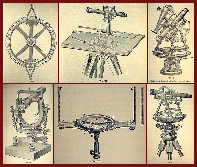
"ELEMENTS OF SURVEYING AND LEVELING", BY CHARLES DAVIES, LL.D., Author of a "Full Course of Mathematics"; Revised by J. Howard Van Amringe, A.M., Ph.D., Professsor of Mathematics in Columbia College. Copyright, 1870, by Charles Davies; Copyright, 1883, by A. S. Barnes & Co. Published by A. S. Barnes & Co., New York and Chicago. Electrotyped by Smith & McDougal, 82 Beekman Street, New York. -- Table of Contents: BOOK I. INTRODUCTORY PRINCIPLES AND DEFINATIONS. I. Logarithms; II. Plane Trigonometry; III. Instruments for Plotting; IV. General Defintions. -- BOOK II. CHAIN SURVEYING. I. Measurements of Distances: Necessary instruments, To measure a horizontal line, Applications, Standard of measure; II. Area Or Contents Of Ground. -- BOOK III. COMPASS SURVEYING. I. Definitions; II. Surveyor's Compass; III. Work On The Field: Field notes, Necessary measurements on the field, Errors of compass, Measurements by off-set compass, General example, To correct local attraction; IV. Area or Contents Of Ground: Traverse table and its uses, Balancing the work, Double meridian distances, Area, Plotting, Examples, To supply omissions in field notes; Another mode of finding areas; V. Magnetic Declination Or Variation Of The Needle: Definitions, Daily variations (with table), Secular variation (with tables), Method of finding declination (with tables), To find true meridian with compass, Vernier compass and its use, Form of survey bill. -- BOOK IV. TRANSIT SURVEYING. I. Surveyor;s Transit; II. Measurement of Angles: Horizontal and vertical angles, Azimuths and bearings, To find true meridian with transit, Applications to heights and distances; III. Ranging Out Lines, Etc: To range out a line, Measurement of distances by transit, To survey a road, boundary of estate, etc., To survey streets of a town or city; IV. Farm Surveying By Transit. -- BOOK V. LAYING OUT AND DIVIDING LAND. I. Of Dividing Land; II. Public Land of the United States. -- BOOK IV. TRIGONOMETRICAL SURVEYING. I. Making The Survey: Definitions and general remarks, Base line, Signals, Heliottrope, Theodolite, Measurement of angeles, and notes, Reduction of a harbor; II. Filling Up The Survey: By the compass, By the plane table. III. Plotting The Triangulation. -- BOOK VII. LEVELING. I. Definitions and Principles; II. Instruments: Y Level, Leveling rods, Tests of adjustment; III. Leveling In The Field; IV. Section Leveling: Definitions and principles, Drawing the profile, Establishment of the grade, Examples; V. Cross Section Leveling: Slopes, Setting slope stakes; VI. Computation Of Earthwork. -- BOOK VIII. TOPOGRAPHICAL SURVEYING. Definitions and principles, Examples and plotting, Shading and delineation, Topographical signs, U. S. Coast Survey. -- BOOK IX. RAILWAY CURVES. Definitions and principles, Location of curves, Laying off ordinates, Reversed and compand curves. -- BOOK X. MINING SURVEYING. I. Definitions and General Principles; II. Method Of Location Claims; III. Underground Traversing, Etc.: To make the traverse, To reduce the traverse, To plot traverse on the surface, To plot traverse on paper; IV. Practical Application: Problems, Example of a developed mine, Calculation of ore-reserves, Deposit mine with mill connections. -- APPENDICES. A. Solar Compass And Solar Attachment to Transit; B. Sextant; C. Instructions to U. S. Mineral Surveyors. -- TABLES. Logarithms of Numbers; Logarithmic Sines And Tangents; Natural Sines; Traverse Table. -- 204 illustrations, inc. ca. 30 engravings of instruments and tools. 564 pages. Leather-hardcover with gilt lettering on spine. Cover and spine are in rather poor condition, front- and rear covers are detached. (Restoration recommended.)Endpapers with brown discoloration along frailed edges; one text page with damaged edges; decorated paper edges; some pages with corner fold-marks. General condition of pages and binding are good! Early instructions written in ink are included. Dimension of book: 5 5/8" x 8 5/16" x 1 1/2". A Quote from the Preface: "The undersigned is indebted to Professor Rodney G. Kimball, of the Brooklyn Polytechnic Institute, for valuable suggestions and labor, and to the Messrs. W. and L. E. Gurley, of Troy, N.Y. for their courtesy in furnishing him, for use, advance sheets of the last edition of their Instrument Manual and many cuts of their Surveying Instruments." -- Successful bidder agrees: Payment for book and insured mailing must be received within 12 days of auction closure in order to ensure availability of this item. SATISFACTION IS GUARANTEED! If not pleased, notify me within 48 hours of receipt and return the book postpaid/insured, in same condition as received, for a refund less appropriate eBay- and insured mailing costs. -- Thank you for your consideration!

Please download additional image....
Bidding is closed for this item.
If you're the seller or the high bidder - now what?
Details for the seller and high bidder(s):
The seller should contact the
winning bidder(s) with information on the total cost, including shipping, and
where to send payment. The winning bidder(s) must pay the seller directly for
the item(s), and it is the seller's responsibility to fulfill the order when
payment terms are met. The binding contract of the auction is between the
winning bidder and the seller.
If the seller is unable to establish contact with the high bidder within 3 business days of the end of the auction, he/she may lose the place as winning bidder, and be at risk for receiving negative feedback and/or a Non-Paying Bidder warning, both of which can ultimately lead to suspension from eBay.
Seller - Want a safe, easy way to collect payment from the high
bidder(s)?
To collect payment for this item using eBay Online Payments (a
service provided by Billpoint), you can send
the buyer a Billpoint Invoice
| Copyright ©
1995-2000 eBay Inc. All Rights Reserved. Designated trademarks and brands are the property of their respective owners. Use of this Web site constitutes acceptance of the eBay User Agreement and Privacy Policy. |
|