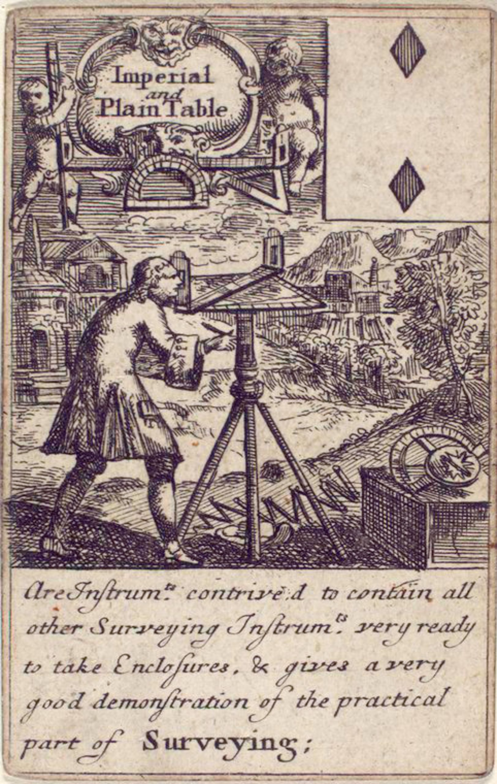
The Plain Table Playing Card Circa 1700
The Plane Table
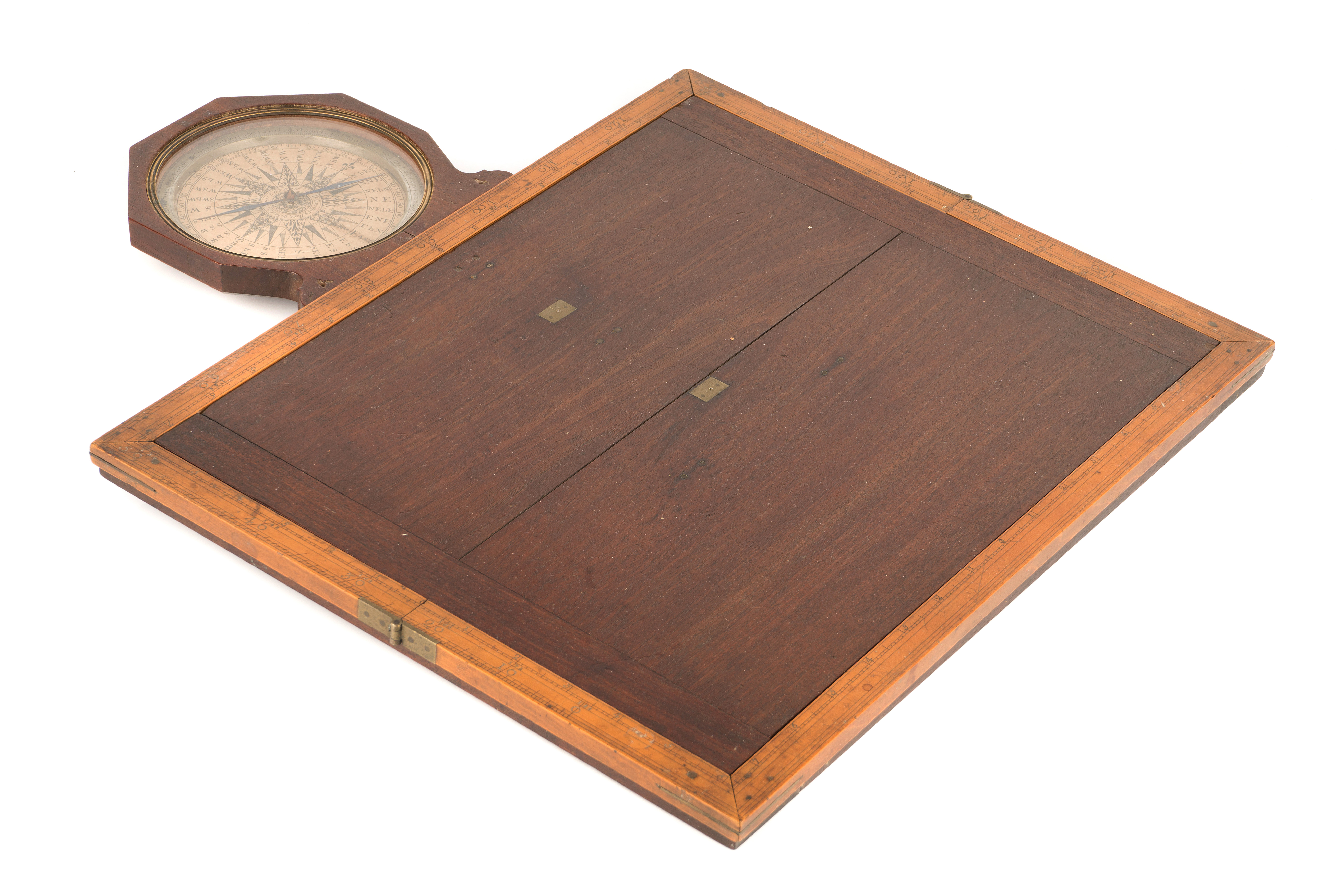
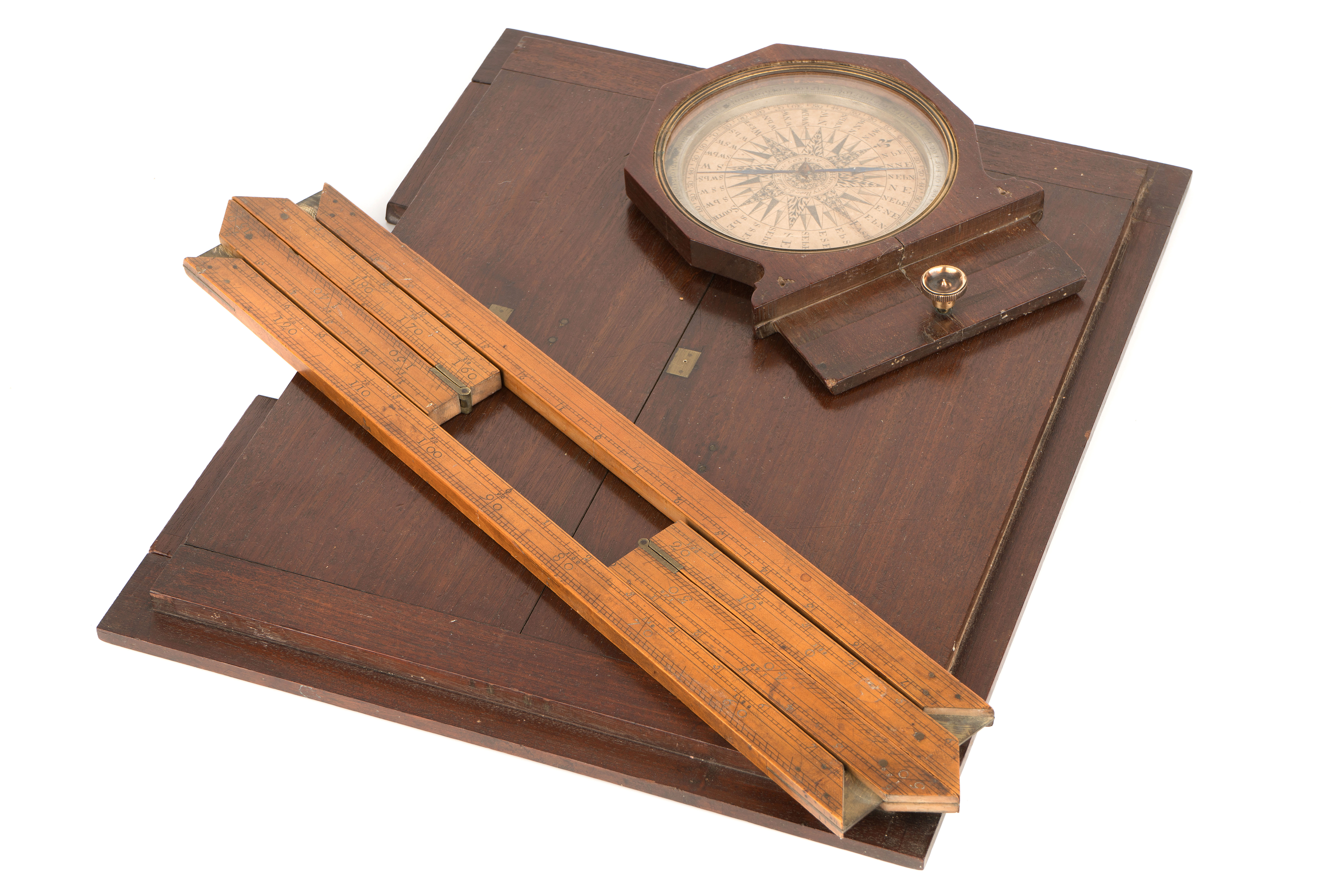
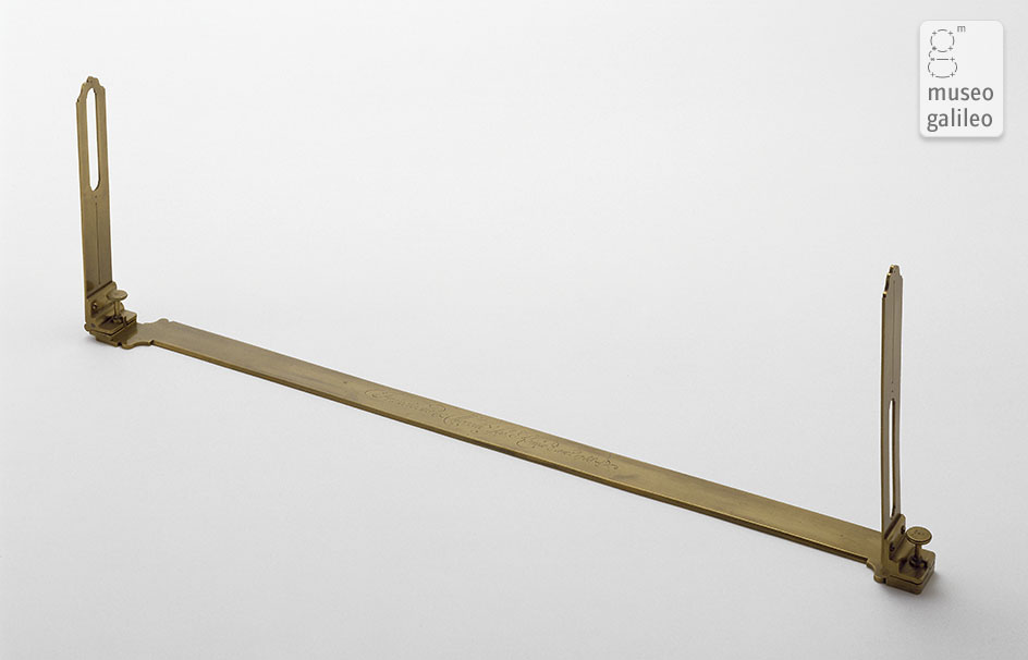
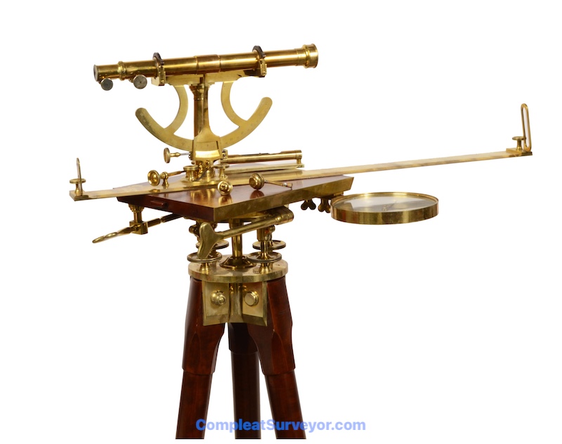
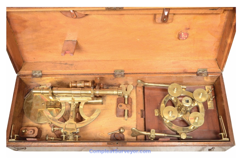
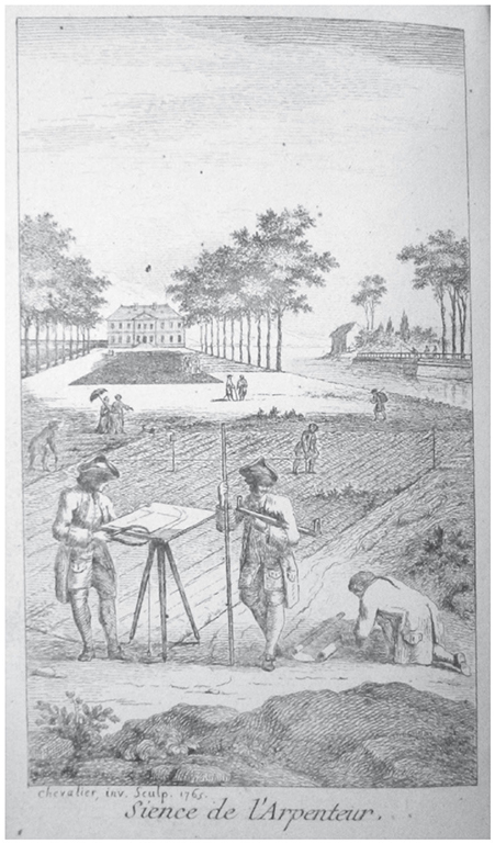
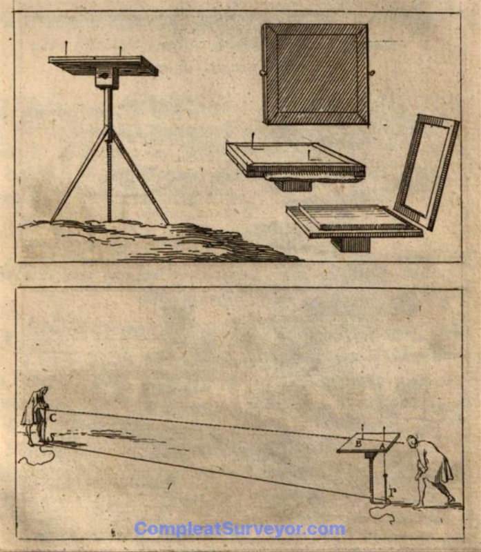
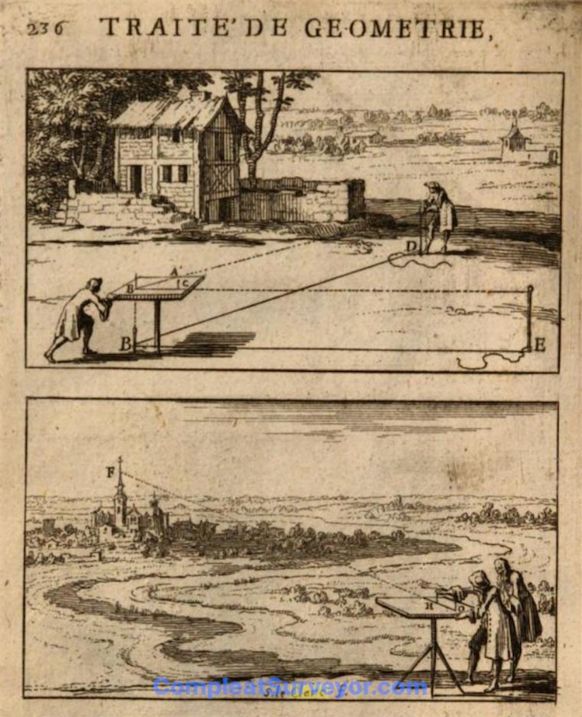
The plane table was a versatile instrument for surveying, particularly when covering a relatively small area, such as several fields or part of an estate. It consists of a flat wooden board mounted on a tripod stand, and a detached sighting rule or alidade. A compass is needed to orient the table, and this can be attached to one side of the board. In use a sheet of paper is pinned or clamped to the board, a suitable point on the paper chosen, taking account of the expected progression of the survey, and lines of sight drawn on the paper towards the other features to be located on the map. The table is then carried to the next station, the distance measured by a chain, and transferred to scale on to the relevant sight line on the paper. The other positions can then be located by triangulation or by further traverses. In this way a map can be drawn on the paper by a purely graphical method, without the need to measure angles in degrees. A variety of sophistications could be added, by including scales on the alidade or on the square surround used to clamp the paper on to the board.
The instrument was first mentioned in Foullon's De Holometre in 1551 (1577 edition is linked), although the table was integrated into a Trigonometry. But it is fairly apparently that the Plane Table was around before 1550.
The instrument became popular in the later 16th century with practicing surveyors, and was widely used in Europe. The plane table ranks with the Theodolite, Compass and Chain for the most used surveying instruments after 1550.
Interestingly, the mathematician authors (who favored geropmetric solutions to measuring land) did not embrace the Plane Table, since the Plane Table's graphical method bypassed the need for a theoretical knowledge of geometry and trigonometry. For example, Thomas Digges stated in the 1591 edition of Pantometria that the Plane Table was “a Platting Instrument for such as are ignorant of Arithmetical Calculations' - 'an Instrument onelye for the ignorante and unlearned, that haue no knowledge of Noumbers”.
NOTE: The Plane Table was generally referred to as the "Plain Table" or "Playne Table" before 1800 in England.
(The above borrows heavily from the EPACT Glossary - Epact is an electronic catalogue of medieval and renaissance scientific instruments from four European museums: the Museum of the History of Science, Oxford, the Istituto e Museo di Storia della Scienza, Florence, the British Museum, London, and the Museum Boerhaave, Leiden. Together, these museums house the finest collections of early scientific instruments in the world.)
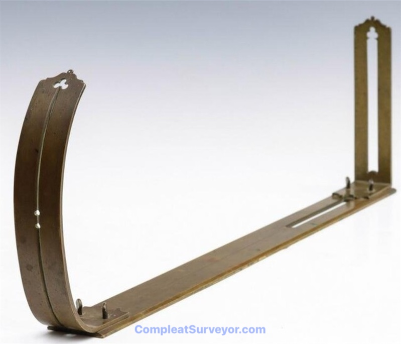
Two Alidades - Regular & Mountain
Collectability
I do not see many complete Plane Tables as I look thru Museum holdings, auction results, and private collections. I suspect that very few wood boards survived over the centuries, leaving only various components (compasses, alidades, rim scales, etc) for interested collectors. Even these component parts are not well represented in museums, auctions and private collections, however. I suspect that collectors are more interested in sophisticated angle bearing instruments than graphically based Plane Table components.
The auction results I see also suggests that a collector can pick up some pretty interesting components, like compasses made for a Plane Table, at very affordable prices. These compasses can make for a nice display item at a very budget friendly price.
Reference Materials - Plane Tables
Plane Tables were used for about 400 years and didn't really change very much. The wood board stayed the same while the alidade swapped out the sights for a telescope in the 19th century.
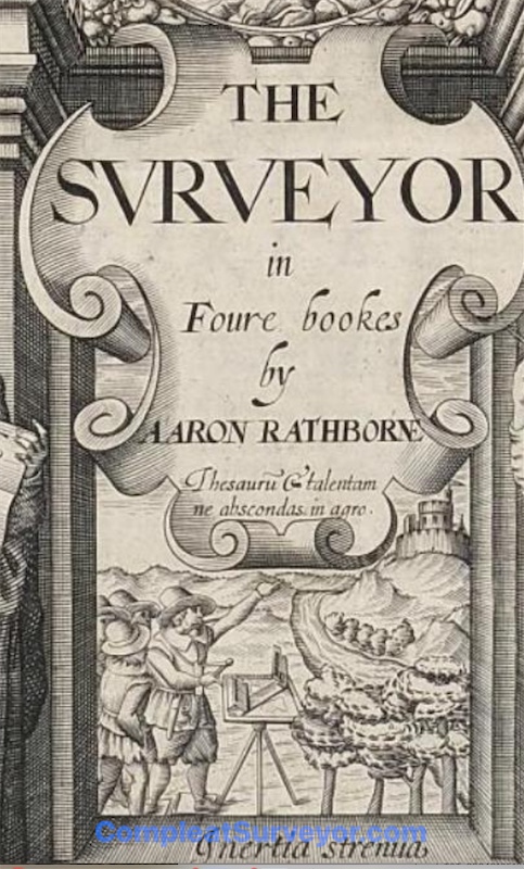
Pics from Rathborne's Surveyor (1616) and an Encyclopedia in 1765
My Reference Materials
Here are the main reference books I used while researching my Ancient Surveying Webpages:
5-Volume Catalogue Of The Most Important Worldwide Private Collection Of Scientific Instruments (With 928 Color Illustrations). Written in German, but an amazing reference tool. The pictures are incredible - most of the instruments are not found on the internet. Crazy Expensive.
Bennett's Catalogue of Surveying and Related Instruments (2022). Fantastic pics and info about the surveying related instruments at the Galileo Museum (which has an INCREDIBLE collection of early instruments).
Bennett's The Divided Circle (1987). A History of Astronomy, Navigation and Surveying Instruments.
Delalande Antiques Two Volume book series on Astrolabes. The two volumes walk you thru how to use and collect Astrolabes. A must have if you want to collect Astrolabes.
Kiely's Surveying Instruments - Their History (1947) Somewhat dated now, but still has a great deal of relevant information. Not the easiest read, however.
Daumas' Scientific Instruments of the 17th and 18th Centuries (Translated into English 1972).
Richeson's English Land Measuring to 1800 (1966). A nice book that is mis-paginated unfortunately. But still contains some good information about early English land surveying.
Important Websites where you can use the search function (e.g. "Theodolite") to find instruments:
The Museo Galileo Virtual Museum - A Stunning Collection of Early Surveying Instruments
The Science Museum Group (UK Based)
Harvard University Collection of Scientific Instruments
The Museum of History and Science, Oxford
© 2020 Russ Uzes/Contact Me