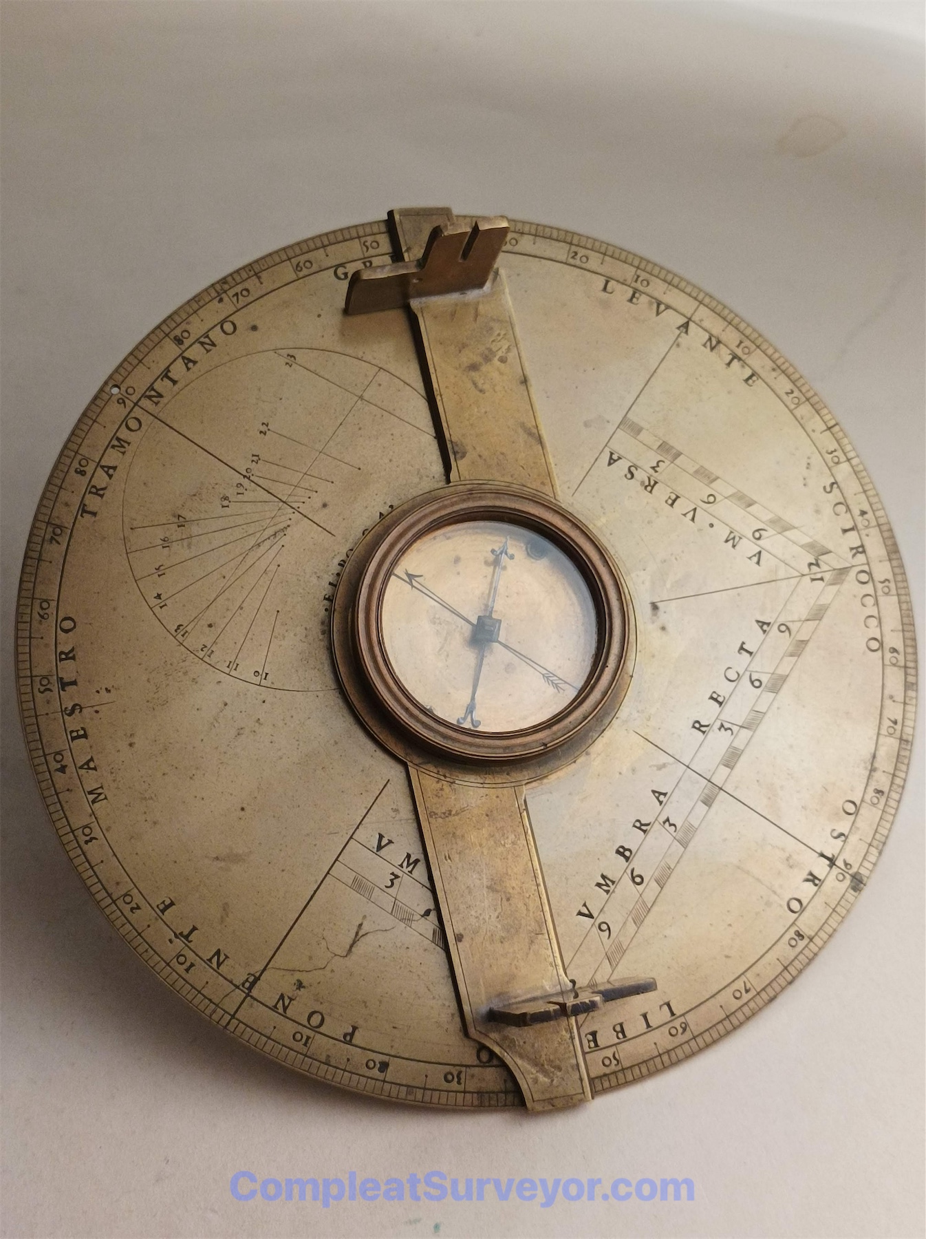
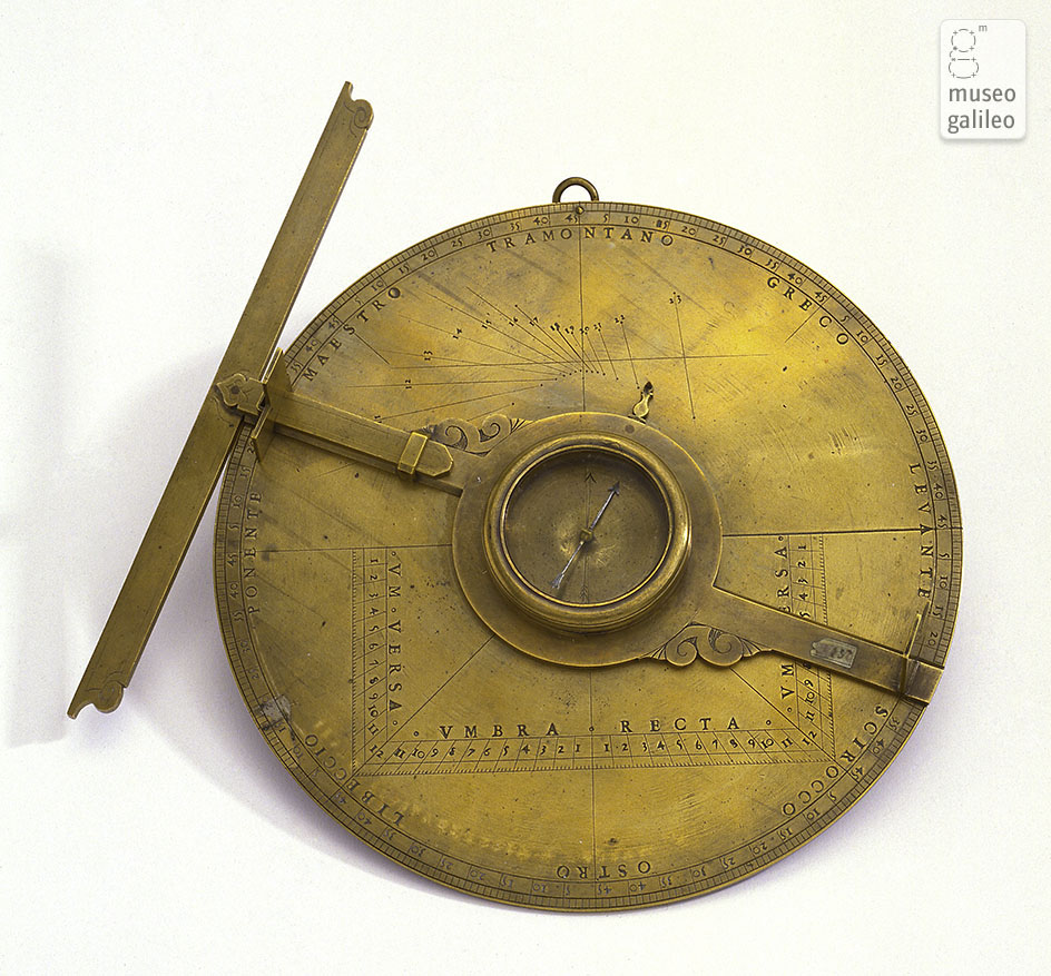
Circa 1575 Simple Theodolite Attributed to Giovan Battista Giusti
The Evolution of Surveying Instruments (1500 to 1800)
Babylonians, Egyptians and Chinese surveyed land thousands of years before the Birth of Christ. Thereafter, early Greeks made huge advances in geometry, and likely developed instruments (levels and angle measuring) that reflected the advances in geometry. After the Greeks, the Romans were wonderful engineers (roads, aqueducts, etc), and focused on using simple and more efficient instruments than perhaps those used by the Greeks.
[If you want to read more about early surveying, take a look at this website. For an in-depth look at Greek and Roman Surveying Instruments, you should consider buying Lewis' book published in 2009 - you can find it here. Finally, for a freebie book on Roman Surveying Instruments, you can download Stone's 1928 booklet here.]
Very little surveying occurred after the fall of the Roman Empire. From roughly 500AD to 1500AD, Europe focused on spiritual matters more than economic development. Moreover, much of the land was held in large unenclosed feudal estates, where the boundaries could be described by topographical reference points. As a result, there wasn't much demand for new roads, aqueducts, maps and other things that required knowledge of surveying. The only meaningful surveying instrument developed during this time was the Astrolabe - which were really astronomical instruments devised in the Muslim world that in theory could be used as a surveying instrument. What little surveying occurred was likely done by measuring land by a rope or a pole.
A variety of 15th century developments would eventually greatly increased the demand for surveys, surveyors and survey instruments. Constantinople, where a great deal of Greek learning existed in book form, fell in 1453, which allowed Europe to tap into all of the Greek knowledge, including Geometry. At roughly the same time, the Gutenberg press was invented, which greatly accelerated the dissemination of knowledge including the newly acquired Greek knowledge about Geometry. Additionally, the ancient feudal system with its large unenclosed estates started to give way to a land system based on enclosure with the lands owned by many more parties. Likewise, with the invention of cannons, the design of military forts became much more strategic, requiring surveyors to help design precisely built forts. Finally, trading between geographically separate communities started to increase, giving rise to the need for accurate maps.
The re-discovery of Geometry and the demand for more surveys triggered a great leap forward in surveying instrument technology in the 16th century. Mathematical thinkers and practitioners invented a variety of new instruments and published books focused on the principles of Geometry and the usage of the new instruments. Some of these 16th Century instruments, like the Theodolite, Semi-Circle (Graphometer) and Plane Table, were extremely successful instruments for a very long time. Other 16th Century instrument designs, especially the Triangulation devices, were overly complicated and quickly forgotten (although very collectible now).
The 17th and 18th Centuries witnessed the development of Circumferentors (aka - a surveyor's compass in America), Levels, and Sectors/Proportional Compasses. Surveyor's Compasses were the instrument of choice for surveying newly discovered or undeveloped countries like the Americas and Ireland. Levels were primarily used for waterways, and would become a mass produced instrument with the invention of railroads in the early 19th Century.
The 17th and 18th centuries also witnessed the development of the Survey Chain and Surveyor's Cross. While surveyors used poles, ropes, various types of chains and right angle devices prior to the 17th century, the development of the Gunter 66ft chain was very significant, and the Gunter chain simplified land acreage calculations and thereby became by far the most popular measuring chain. The Gunter chain was often used with a Surveyor's Cross to make sure that lines were perpendicular to each other.
Finally, the 17th and 18th Centuries witnessed the on-going refinement of Theodolites. One could argue that the Theodolite is the most important surveying instrument ever invented on a worldwide basis. I see three distinct generations of Theodolites in the 1500 to 1750 period:
First Generation Theodolite (1500 to 1600): A full circle brass disc divided into 360 degrees, with a compass in the middle and a moveable alidade. Could be used vertically to measure heights. This instrument was essentially the back plate of an Astrolabe with a compass added.
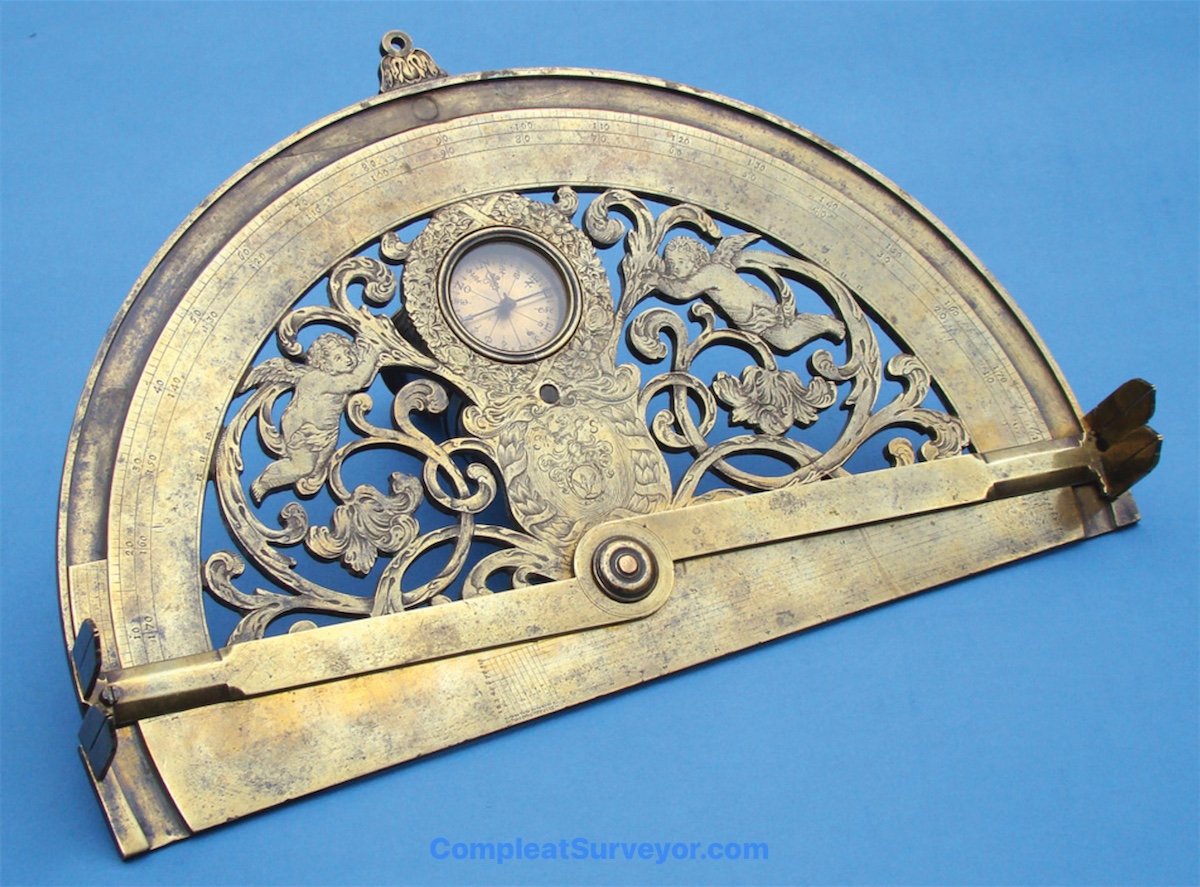
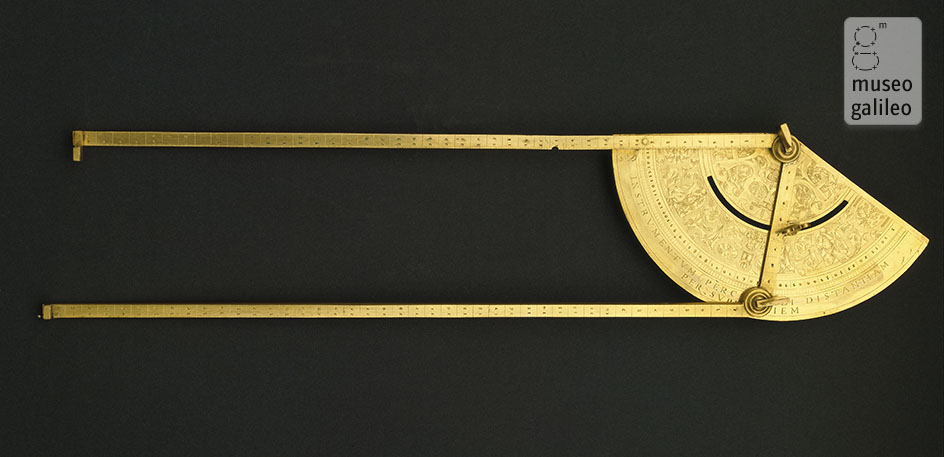
Second Generation Theodolite (1600 to 1725): Significantly larger than a First Generation Theodolite, with cutouts in the brass disc to save weight. Would often have trigonometric scales and/or a Polygon Scale for military fort design. Many early Second Generation Theodolites could still be used vertically to measure heights. Later Second Generation Theodolites generally were designed to be used only to measure horizontal angles, and usually had a larger central compass that was divided into 360 degrees as well.
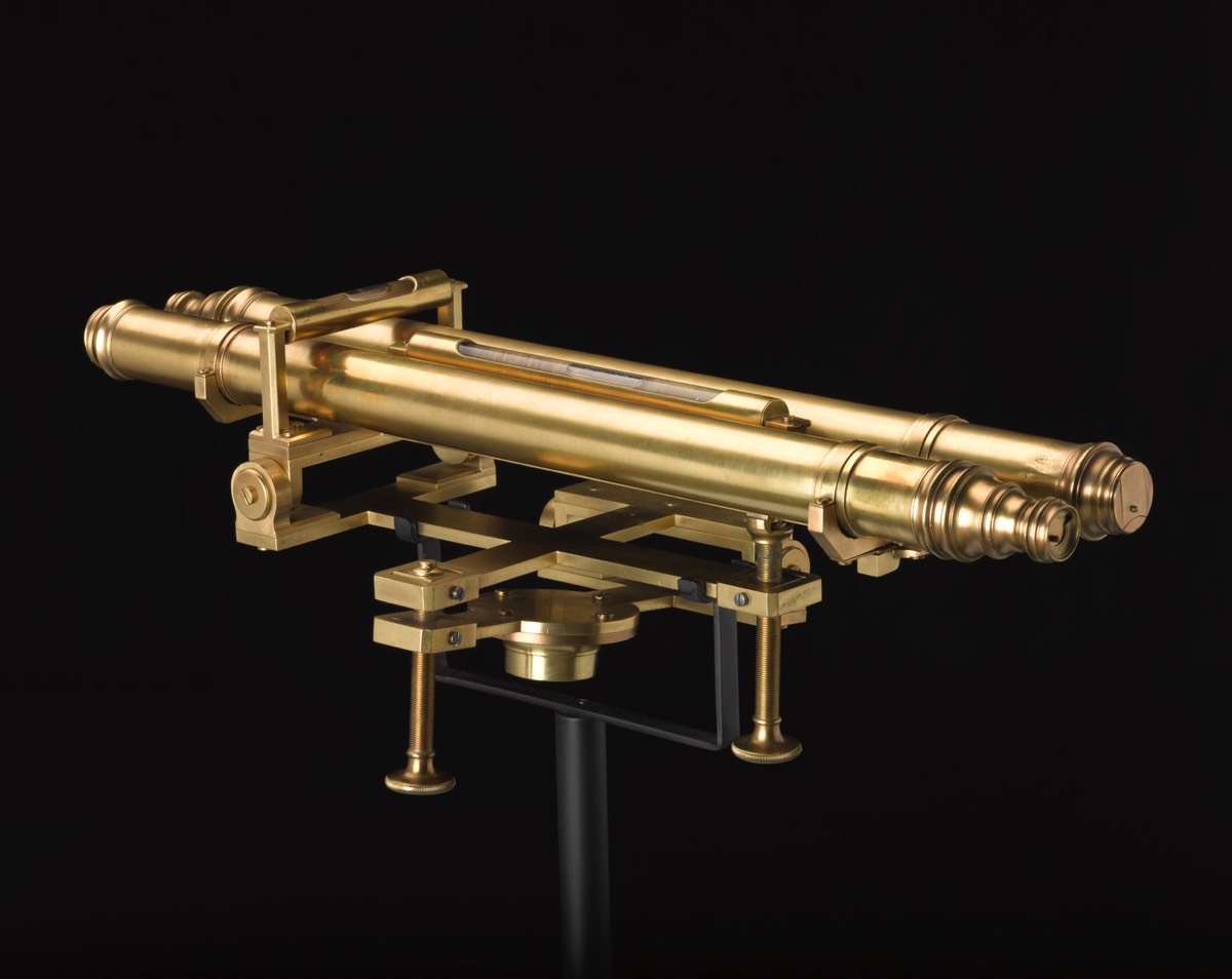
Third Generation Theodolite (1725 et seq): A Second Generation Theodolite with the addition of a telescope and a vertical arc. The instrument that basically changed EVERYTHING, and would become the most important surveying instrument ever invented. Sometimes called an Altazimuth Theodolite.
The Important Surveying Instruments Used From 1500 to 1800
Below are links to the main surveying instruments used from 1500 to 1800. Popularity and usage varied from country to country. For example, in mid-17th Century, the most popular instruments were the Theodolite, the Circumferentor and the Plane Table. In France, however, the most popular were the Graphometer and Plane Table. Surveying by the chain was widely done almost everywhere.
Very Important Instrument - Started with the Astrolabe, and then evolved from 1500 to 1800 with three distinctive generations.
Great instruments, and some are works of art. I suspect that Europeans made more Graphometers and Semicircles than Theodolites from 1500 to 1750.
Cool but very unwieldy and impractical instruments. Not many made or used.

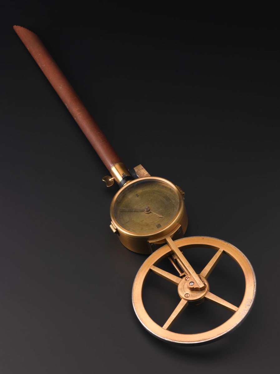
Chains were the surveyor's tool of choice for measuring land. Perambulators were used to measure long distances, like roads.
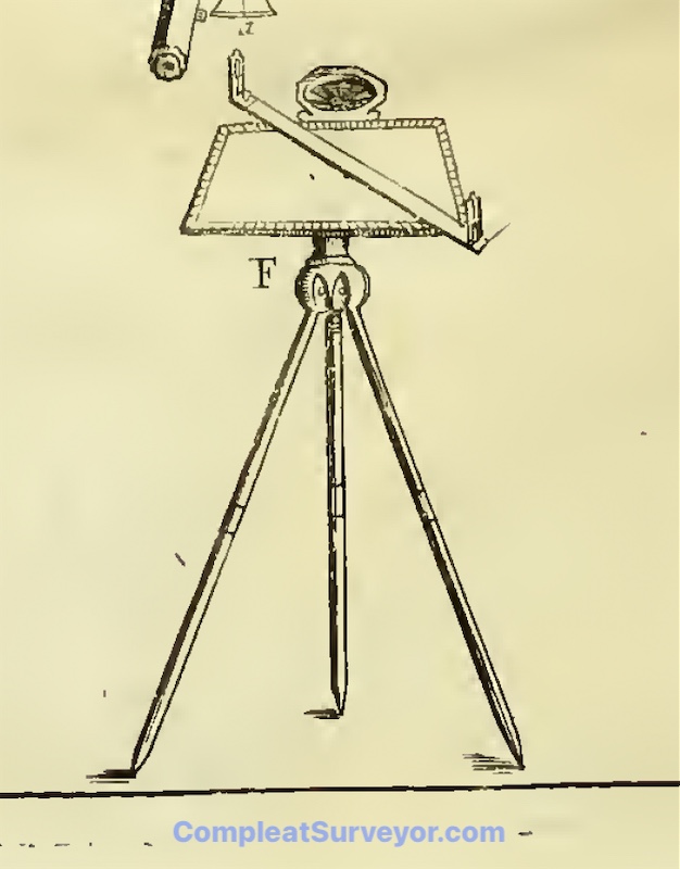
The Plane Table was one of the most popular instruments for centuries, and it allowed a surveyor to survey and draw a plat map at the same time.
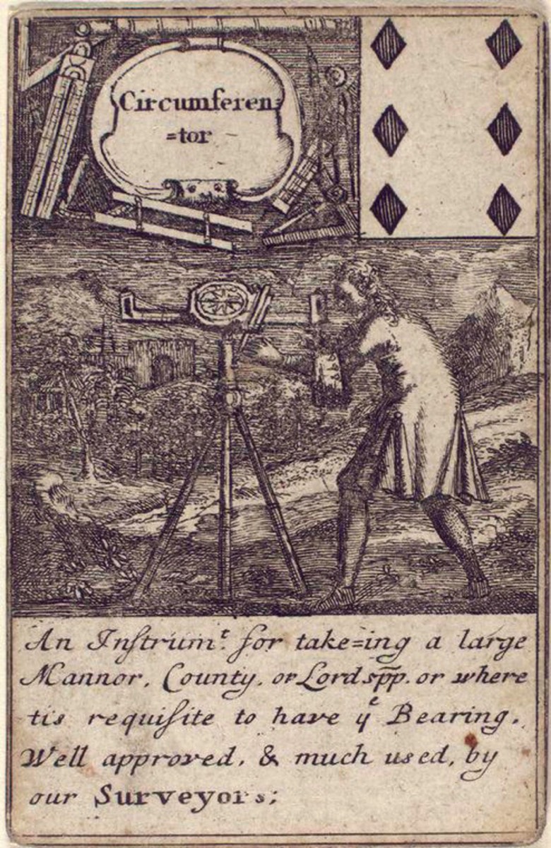
Back in the day, everybody called a basic Surveyor's Compass a Circumferentor. And now when people call something a Circumferentor, they are probably referring to a Simple Theodolite. Sound Confusing? Yep - it is.
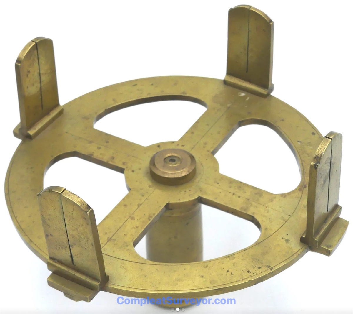
A Surveyor's Cross is a simple device designed to measure right angles. Often used with a Chain
Levels were used mainly for transporting water. Interestingly, many early levels involved a two-telescope setup.
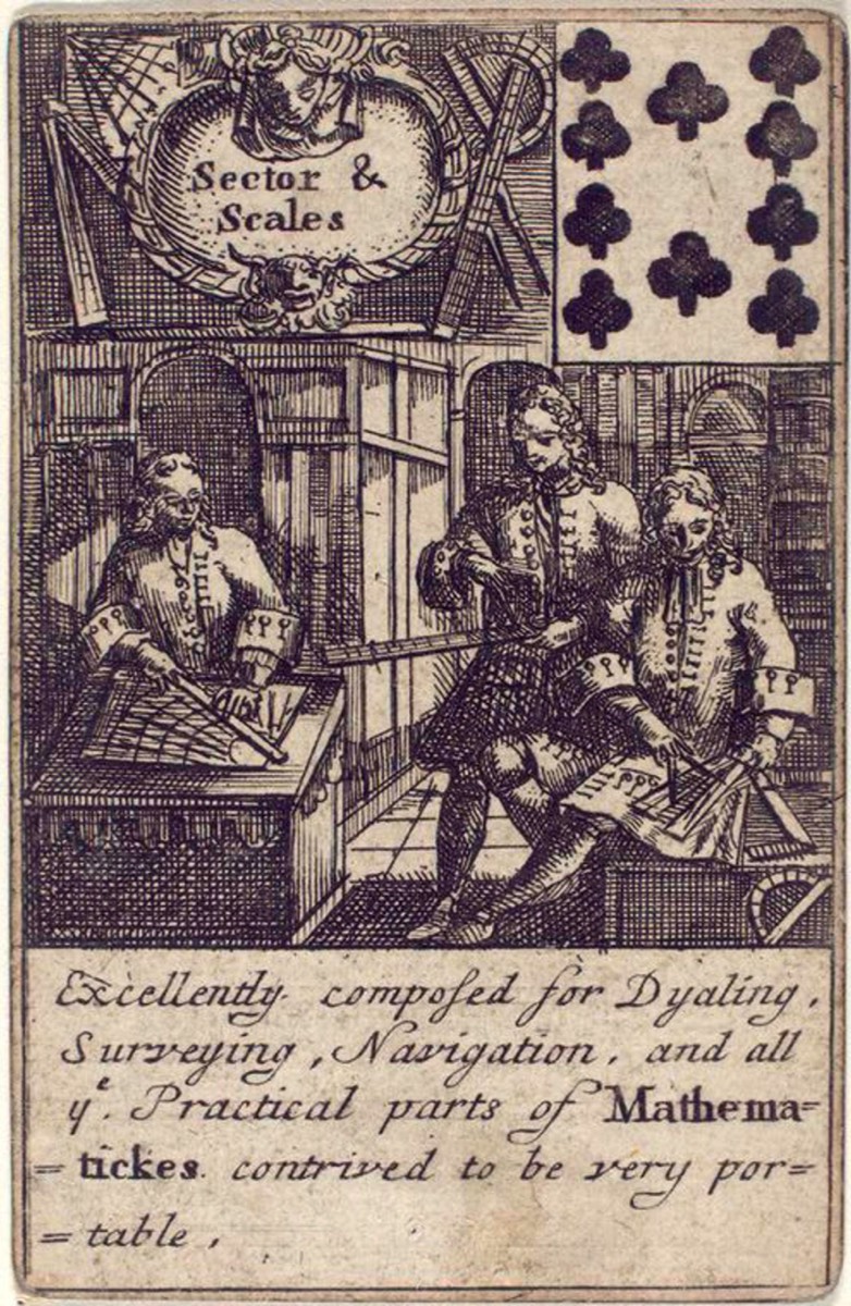
A small percentage of the Sectors made included sight vanes and could be used as a Surveying Instrument.
My Reference Materials
Here are the main reference books I used while researching my Ancient Surveying Webpages:
5-Volume Catalogue Of The Most Important Worldwide Private Collection Of Scientific Instruments (With 928 Color Illustrations). Written in German, but an amazing reference tool. The pictures are incredible - most of the instruments are not found on the internet. Crazy Expensive.
Bennett's Catalogue of Surveying and Related Instruments (2022). Fantastic pics and info about the surveying related instruments at the Galileo Museum (which has an INCREDIBLE collection of early instruments).
Bennett's The Divided Circle (1987). A History of Astronomy, Navigation and Surveying Instruments.
Delalande Antiques Two Volume book series on Astrolabes. The two volumes walk you thru how to use and collect Astrolabes. A must have if you want to collect Astrolabes.
Kiely's Surveying Instruments - Their History (1947) Somewhat dated now, but still has a great deal of relevant information. Not the easiest read, however.
Daumas' Scientific Instruments of the 17th and 18th Centuries (Translated into English 1972).
Richeson's English Land Measuring to 1800 (1966). A nice book that is mis-paginated unfortunately. But still contains some good information about early English land surveying.
Important Websites where you can use the search function (e.g. "Theodolite") to find instruments:
The Museo Galileo Virtual Museum - A Stunning Collection of Early Surveying Instruments
The Science Museum Group (UK Based)
Harvard University Collection of Scientific Instruments
The Museum of History and Science, Oxford
© 2020 Russ Uzes/Contact Me